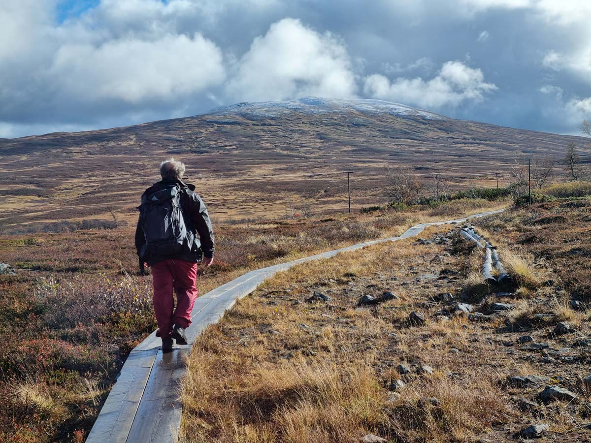
C and I had been talking sporadically about doing a multi-day hike together somewhere around my home turf in Jämtland, and on Friday September 27 it was finally time to put words into action. Our plan for the weekend was to hike from Storulvån to the STF Sylarna mountain huts on Friday afternoon, then spend Saturday doing some exciting objective in or around the Sylarna massif before going back to Storulvån on Sunday. To keep things simple and to reduce the weight of our packs, we’d opted to stay in the STF huts where we’d get dinner, breakfast and packed lunch. The dismal weather forecast, promising strong winds and considerable snowfall over the weekend, doubtlessly also contributed to this decision.
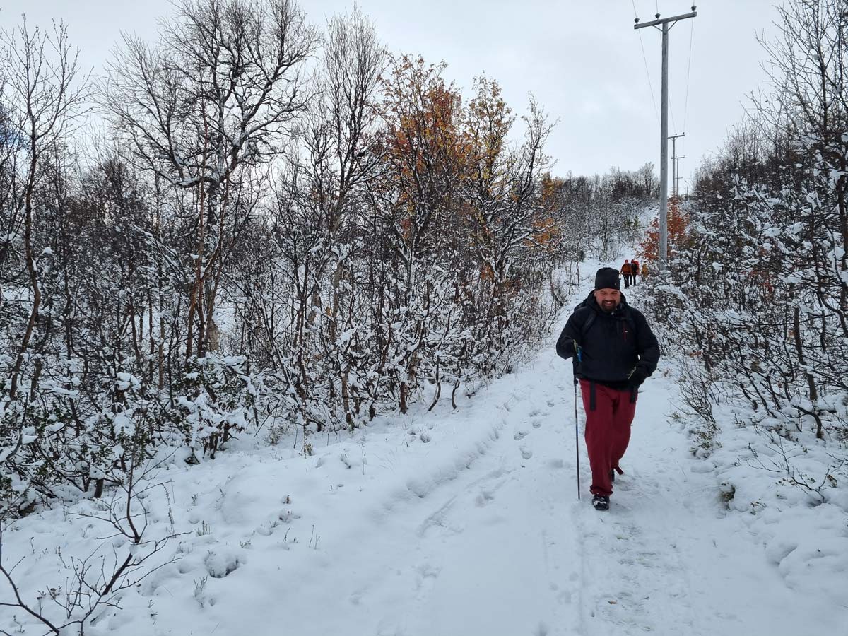
We arrived at my place late the day before, and since both of us had some work to do on Friday morning it wasn’t until around 1 pm that we set off in C’s car, only to immediately make a stop at the grocery store to buy some snacks. An hour or so later we arrived at the parking lot at Storulvån in a light snowfall, and after a brief stop at the STF Storulvån hut/hotel to use the bathroom and to grab something to eat, we started walking. By then it had ceased snowing, and a couple of hours later we found ourselves at the halfway mark at the Spåime shelter in quite agreeable weather. The forecast for the evening promised strong winds and more snow, and since were a bit wary of the conditions on the trail ahead we didn’t loiter and after a quick snack we set off again.
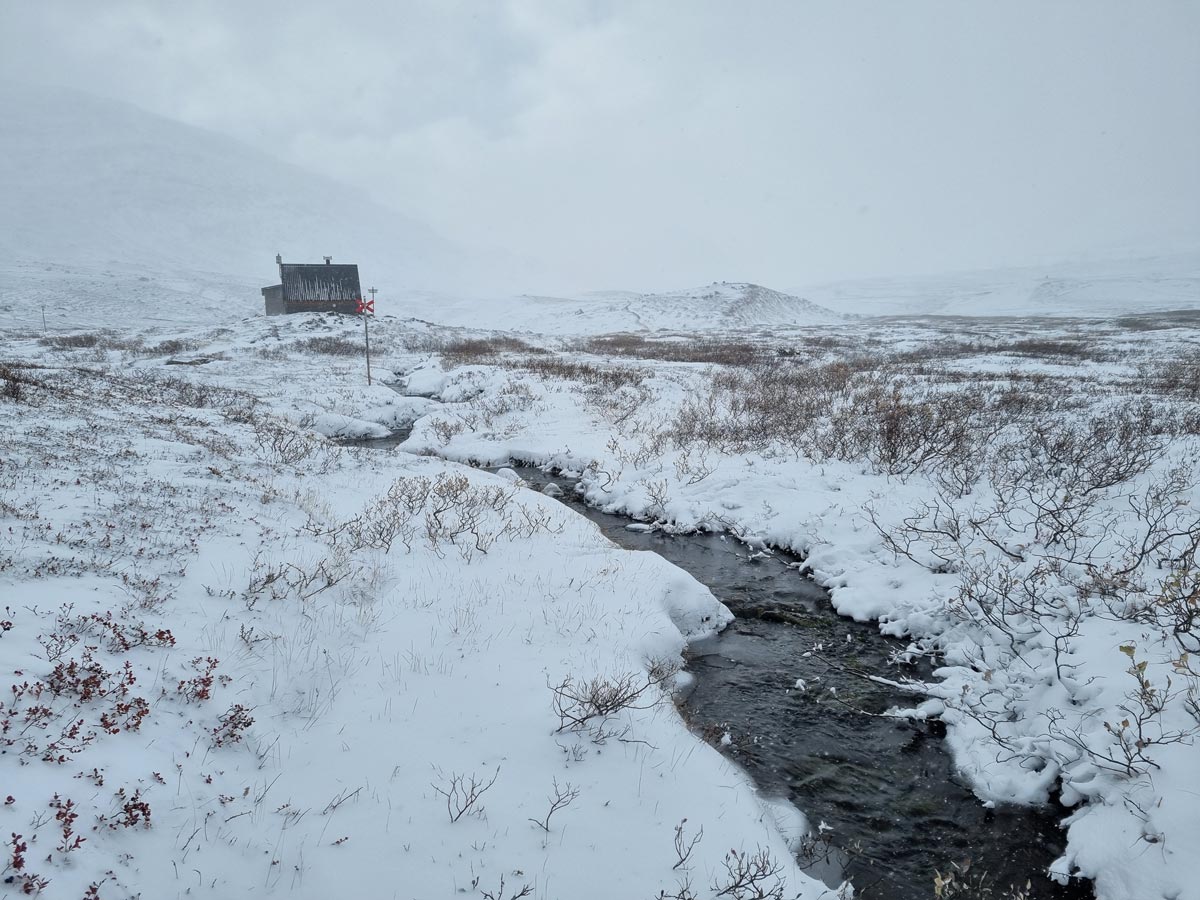
Luckily trail conditions turned out better than we’d expected. At Spåime only patches of snow were left from the snowfall the night before, and by the time we reached huts, some 4.5 hours after we’d started walking, snow covered most of the ground but didn’t hinder us much and navigation was never an issue. After a commendable dinner and a well deserved sauna and shower we spent some time chatting in the lounge area before hitting the beds. Outside the wind was picking up and snow had begun to fall.
A bit to our surprise, we awoke to quite agreeable weather the next morning. The snowfall had ceased and the wind had let up a bit, and even the sun made intermittent appearances between racing clouds. We discussed our options for the day over breakfast, and decided to take the trail to Storsylen, 1762 m, the highest peak in the area, hoping to get a glimpse of the recently collapsed glacier and, weather and snow conditions permitting, maybe even summiting.
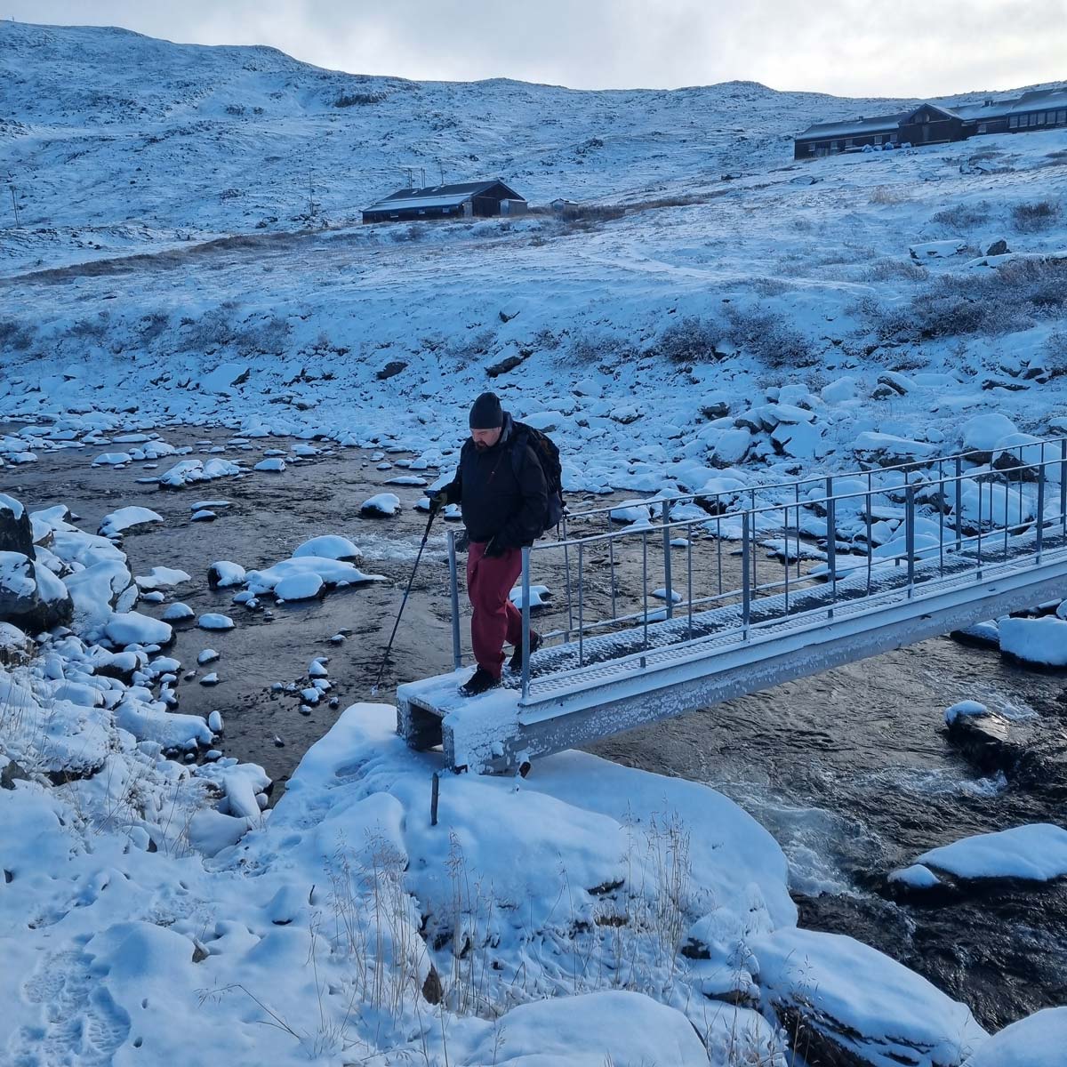
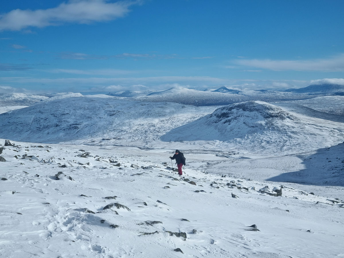
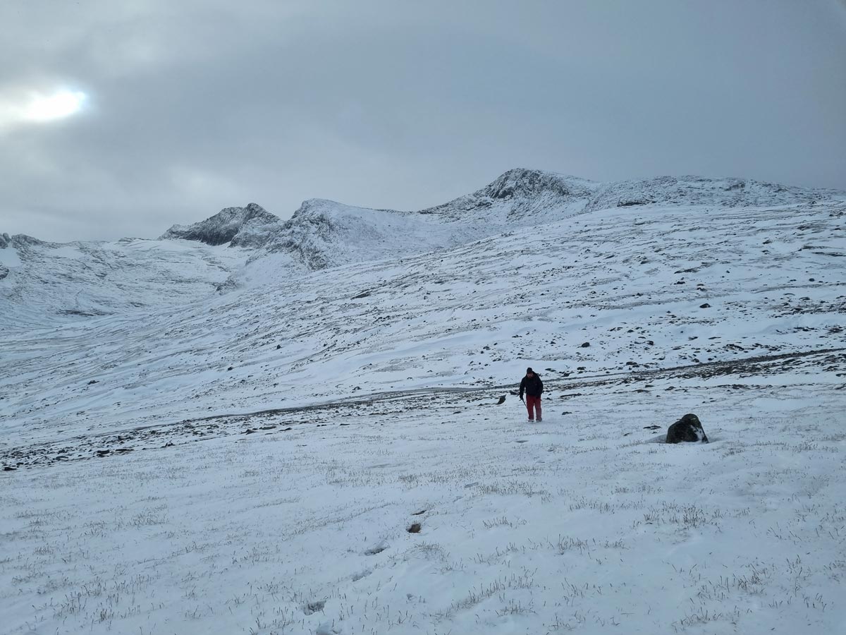
We set out at around 9:30 am, crossed the small footbridge over the Sylälven stream that runs past the huts and then continued west along the trail up a gentle slope. Navigation was facilitated by fresh tracks in the snow, but the wind did a good job of filling them in and for long stretches we had to break trail ourselves. As we climbed higher the sky cleared up behind us, and we were soon treated to stunning views of a snow covered landscape of rolling mountains stretching out eastward under a clear September sky.
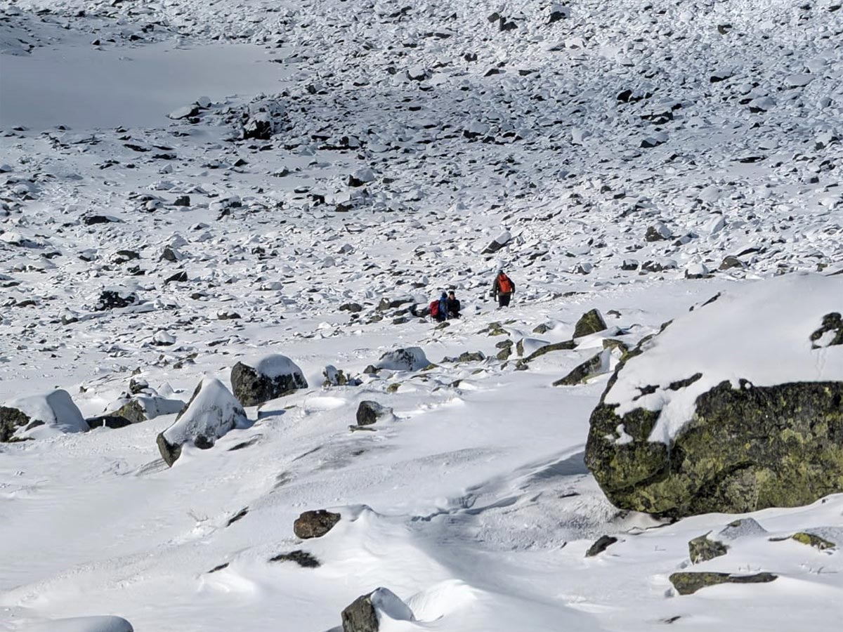
Right at the point were the slope steepens and the trail becomes more technical we ran into a small group of people heading back toward the huts. We chatted for a bit and they told us that they’d set out early to reach the summit in decent conditions but that strong winds at higher elevations had forced them to turn around. Another hiker, not part of their group, had decided to continue alone. This sparked my interest, and after saying goodbye to the group, C and I decided to continue up the steepening slope to see how we’d fare against the wind and snow higher up.
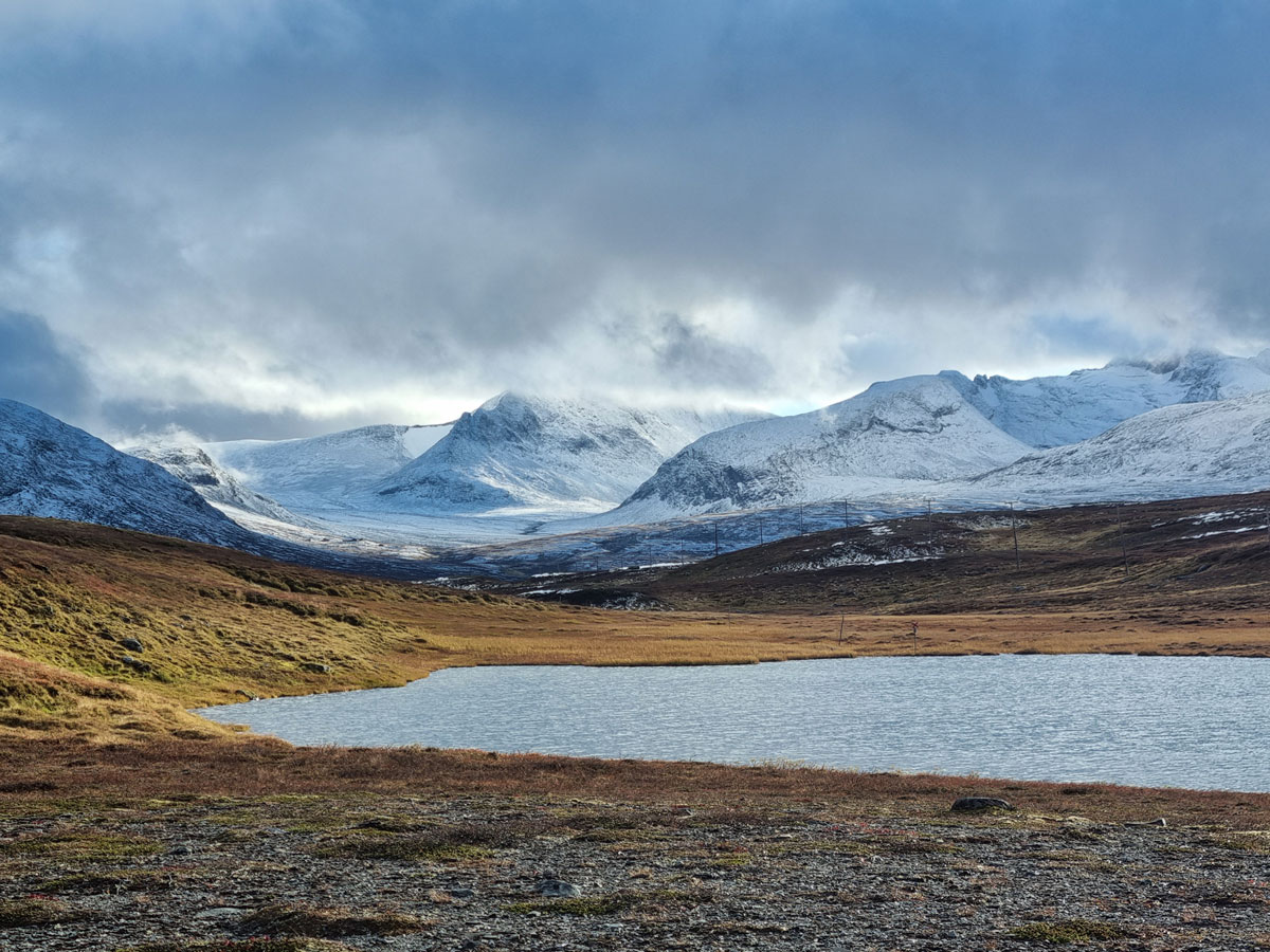
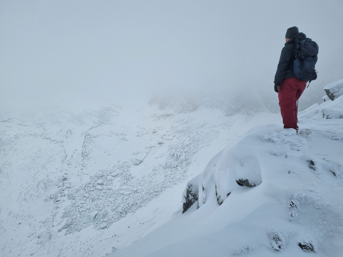
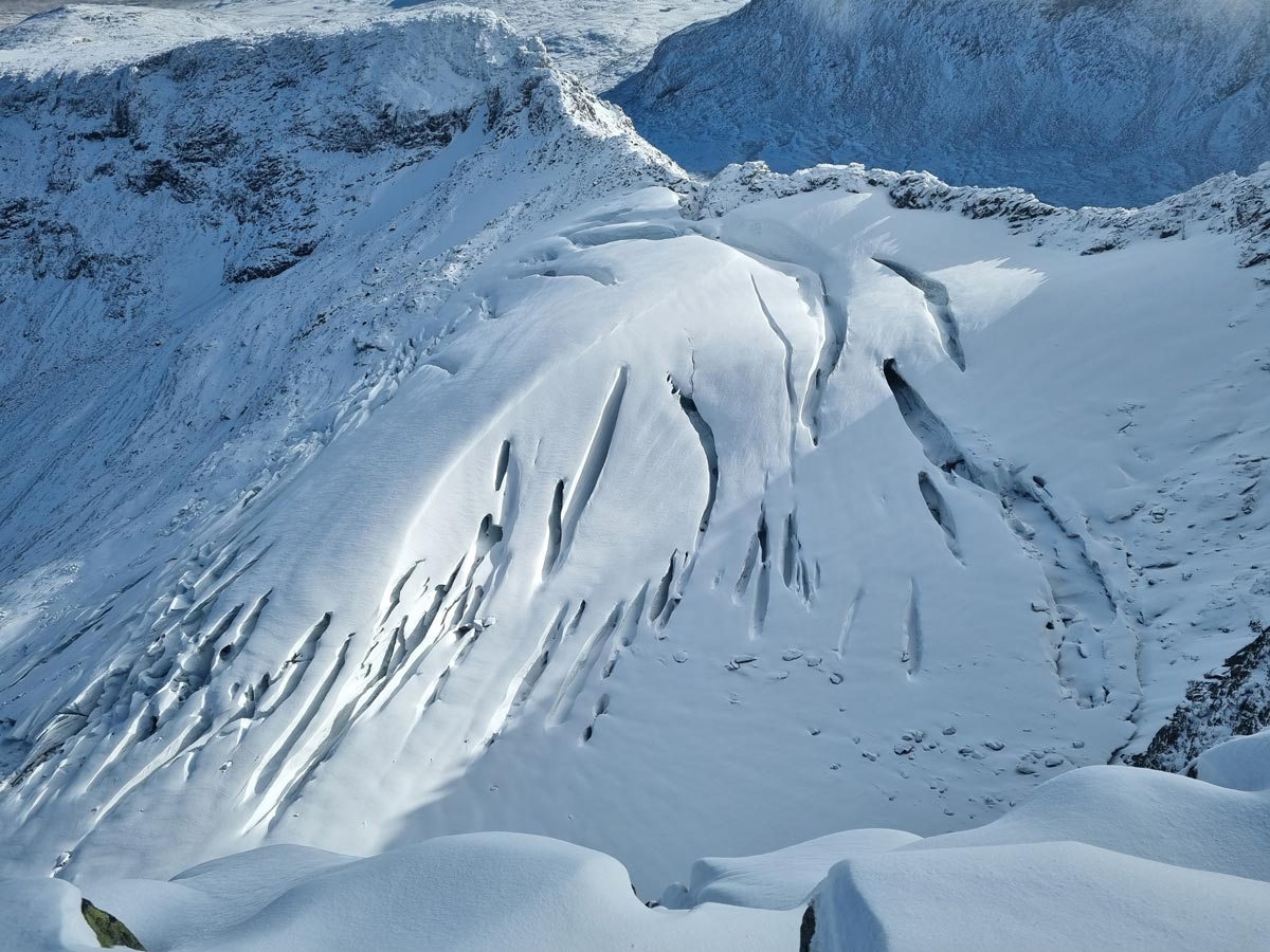
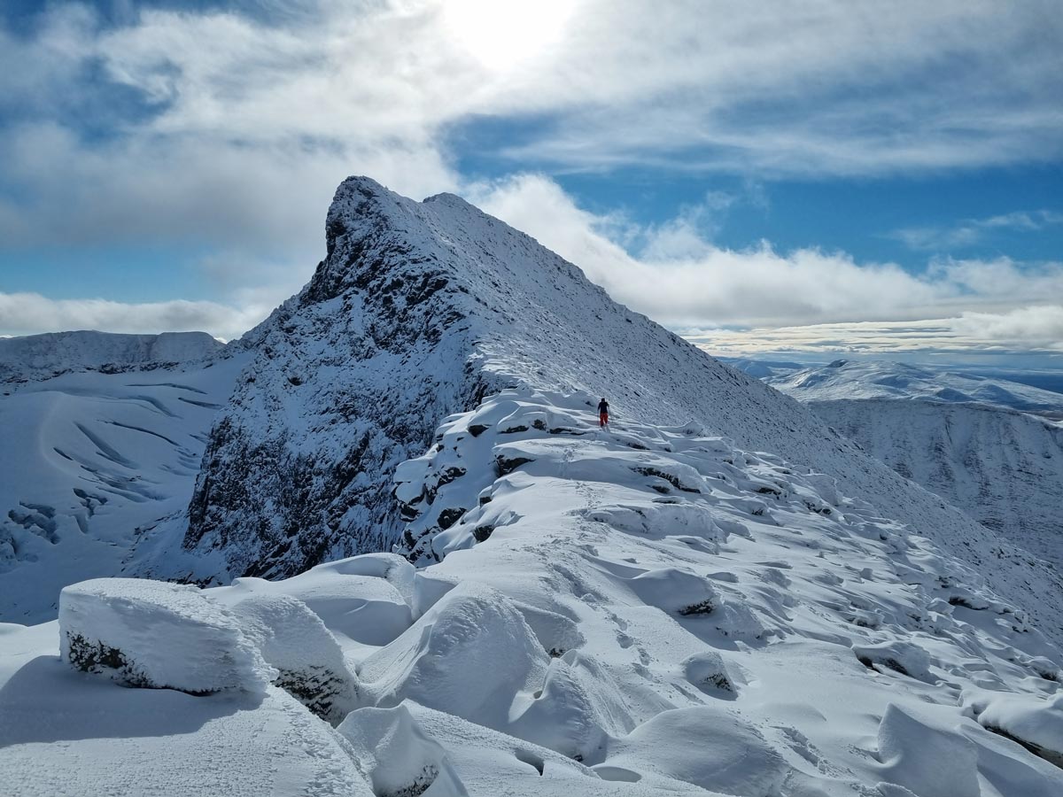
The pace slowed down significantly now, but it didn’t take long before we reached the east ridge of Pyramiden (1624 m, a small pyramidal summit on the ridge between Storsylen, 1762 m, and Lillsylen, 1702 m) where we were met with dramatic views of the Sylglaciären glacier, the northern part of which had collapsed just a week earlier after a poor snow season followed by a warm summer and heavy rains. C was beginning to feel tired and didn’t want to push his luck in the increasingly technical terrain, so he decided to stay and rest for a bit and enjoy the view before starting the descent. I wanted to push on, and since the forecast promised gradually worsening weather in the afternoon, I quickened the pace and started off along the ridge, following footsteps in the snow that I assumed had been left by the lone hiker mentioned by the group we had spoken to earlier.
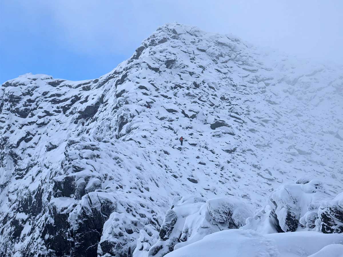
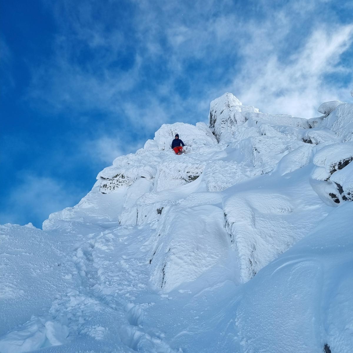
Right before the summit of Pyramiden I had to resort to some scrambling to navigate through a section of larger blocks. Here the snow was deep enough that my high ankle hiking shoes could no longer keep it out, and I could feel my feet getting wetter by the minute by the melting snow. The track I’d been following suddenly made a sharp turn away from the ridge, traversing out onto a blocky slope. There, in a small recess between rocks I found a red backpack, and gazing along the track I spotted its owner, the lone hiker, cautiously making her way toward a saddle in the ridge above. I decided to take the more direct path and soon found myself on top of Pyramiden, where I was greeted with magnificent views in all directions. To my great relief the wind had dropped, and the last scramble to the summit, past the cairn that marks the Norway-Sweden border, although a bit more challenging than usual due to the fresh snow, was truly enjoyable.

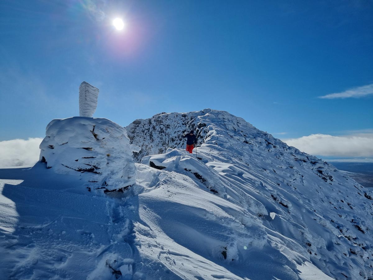
I reached the summit at 1 pm in brilliant sunshine and lingered there for a bit, taking in the view and assessing the situation. It was the calm before the storm. Rough weather was quickly approaching from the west and I estimated that it would reach us in an hour or so. Before long the lone hiker joined me. She had noticed me right around the time that I had spotted her, and had followed my tracks to the summit. She gave her name as S. We chatted for a bit, commented on the weather, and decided to keep an eye out for each other during the descent, for company and safety.
Backtracking our steps, it didn’t take long before we’d made it back past the more technical scrambling sections, and soon the terrain leveled out and we found ourselves in slightly more amiable surroundings. At this point we decided to part ways and said goodbye, and as S headed straight back toward the huts I made a detour to Glaciärsjön (Glacier Lake) where I’d spotted C a bit earlier during the descent. I first found his tracks and then found him right by the lake, and after snapping some photos we too headed back to the huts, trying to save some time by taking a slight shortcut that cut across flattish ground that turned out to be waterlogged and miserable to walk on under the deceitful snow cover. Somewhere along the way I stepped into a small, but surprisingly deep, creek, and by the time we were back at the huts my feet were sloshing around inside my soaked shoes.
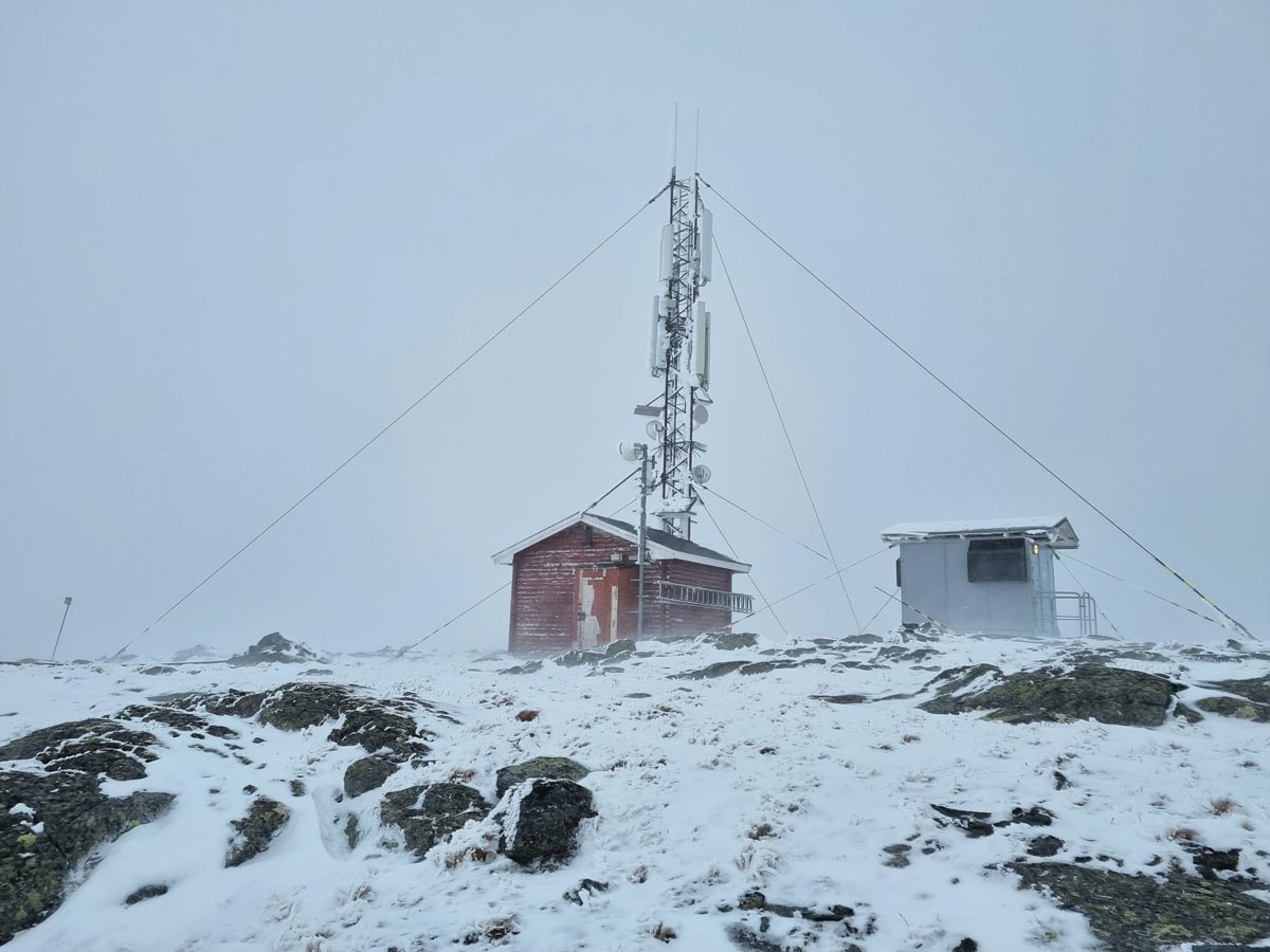
Now the wind was picking up again, and C decided to call it a day, at least as far as outside activities were concerned, and went inside. I was in the mood for another summit, and it was not yet time for dinner, so I decided to have a go at climbing Fruntimmersklumpen, 1308 m. It’s an easy hike to the summit and right next to the huts, but the weather was deteriorating quickly and by the time I made it to the summit, which is adorned by a 4G mast, the wind was rather unpleasant and I made my way down as fast as I safely could, eager to get to spend some time in the sauna before dinner.
The next day we awoke to yet more snow, but again hiking conditions turned out to be surprisingly good, although quite a bit more challenging than usual. Our only objective for the day was to make it back to the car at Storulvån, hopefully in time to stop for lunch somewhere along the ensuing drive. Similar to the previous day, the weather was expected to deteriorate in the afternoon, so we tried to make reasonable haste, only stopping occasionally to have a quick snack or to adjust our backpacks, or to figure out where the trail went underneath the snow. We made remarkably good pace and overtook several other parties, arriving at Storulvån in around 4 hours after setting out from Sylarna, leaving us with plenty of time to eat and enjoy the rest of the afternoon in that strange state of mind characterized by a mixture of relief and contentment that oftentimes kicks in after a successful expedition in demanding conditions.